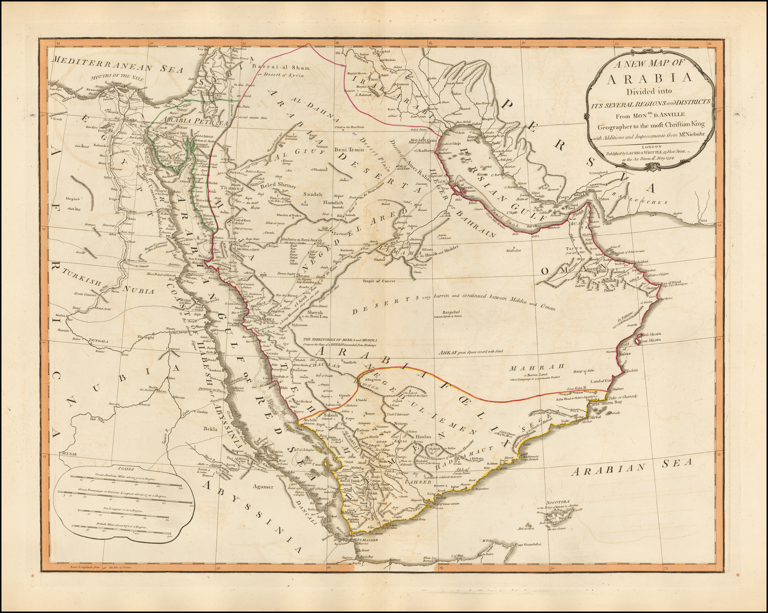
And so, Vogel does provide an interesting perspective of a map that Smith may or may have not perused. We cannot say. However, shall we look at a sister map of the one we have considered in this thread? It's by the same map maker, Laurie & Whittle, and was issued out of London during the same year, 1794. Zoom in to Delmarva and note the green shading used to designate boundaries and pay close mind to the narrow neck. What do you see? Two rivers flank the narrow neck of land! The Susquehanna and Delaware rivers!!
You can be sure that *if* Joseph Smith had viewed the Arabian map suggested by Vogel, he would have also viewed the North America map and would have paid close attention to his own neck of the woods -- from New York to the coast. And we can clearly see that the rivers are positively identifiable for what they are and the bays are what they are.
Zoom in and see for yourself, there is no mistaking what a river looks like on maps produced by Laurie & Whittle in 1794:
A New Map of North America
I have to conclude that Vogel's theory does not hold water. Sorry, Dan.
Valley of Lemuel in Arabia?
Maps
It's hard to imagine Joseph Smith mistaking the gulf or a bay in the Red Sea for a river on a Laurie & Whittle map. I don't buy it! Please refer to the EXPLANATION in the lower right corner of the North America map in which Smith would have relied on as would any map user. Several symbols and explanations for those symbols are provided including Falls in Rivers. There simply is no mistaking what a river looks like on the map. It consists of solid squiggly lines.
A prime example of a river entering into a bay or gulf is shown on the cut-out at the bottom left corner of the North America map. It clearly shows, in no uncertain terms, the Rio Colorado river enters into the northern tip of the Sea of California.
I'm afraid Vogel's theory does not work. Will Vogel own up to the obvious logical conclusion? I'm not holding my breath.
Maps
Baby,
Surely also, you can trust yourself when you look at Laurie & Whittle maps of North America and Arabia and conclude that a river is a river and a bay is a bay. Zoom in and see for yourself -- there are no rivers leading into the bay or Bahr (sea) el Acaba. Why can't Vogel see that? Maybe he needs glasses?

-
Dr. Shades

- Founder and Visionary
- Posts: 1946
- Joined: Mon Oct 26, 2020 2:48 pm
- Contact:
Re: Valley of Lemuel in Arabia?
Hi Shulem,
What's the relationship between that graphic and the content of your post?
What's the relationship between that graphic and the content of your post?
"It’s ironic that the Church that people claim to be true, puts so much effort into hiding truths."
--I Have Questions, 01-25-2024
--I Have Questions, 01-25-2024
Re: Valley of Lemuel in Arabia?
Well, my dear Dr. Shades, lest I become board and disillusioned about what people might think of my opinions, it's necessary for me to get a good laugh, from time to time. And that graphic gave me a damn good laugh!Dr. Shades wrote: ↑Thu Mar 07, 2024 7:59 pmHi Shulem,
What's the relationship between that graphic and the content of your post?